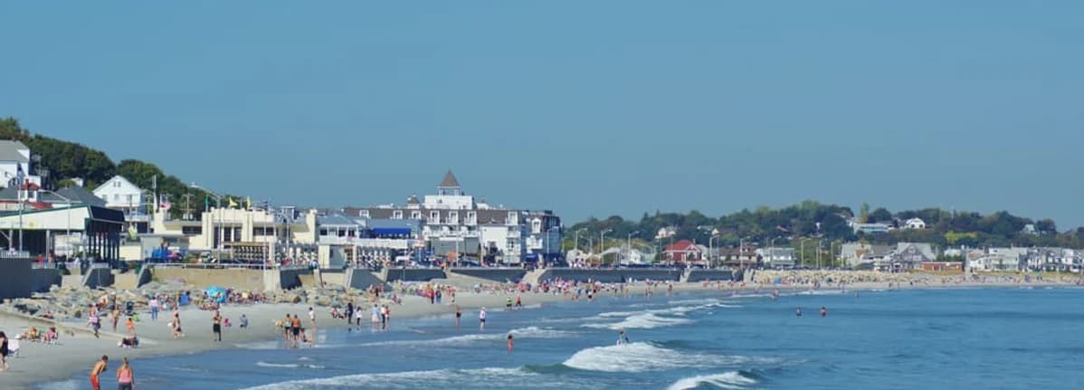
View of Nantasket Beach in Hull

Hull

Nantasket Beach

Hull's premier public beach featuring fine gray sand, extensive tide pools, and a historic seawall. Part of the DCR Nantasket Beach Reservation, it is reached by car, or by ferry or commuter rail and bus 714. Peak season parking fills early.

Plan Your Day

Essential Information

Get the practical details before you hit the sand, from tide timing and transport options to what amenities you can expect once you arrive.

Best Times to Visit

Beach size changes dramatically with the tides: at low tide wide firm sand and tide pools; at high tide the usable area can shrink close to the seawall. Check the tide chart for your visit and plan arrival, space, and gear (chairs, umbrellas) accordingly. Wind, tide turn time and any advisories (water quality, surf) can change the feel of the day.

Weather & Tides

Getting There

Without a car, take the MBTA ferry from Boston to Pemberton Point (weekdays, and weekends in summer), then bus 714 about five miles along Nantasket Avenue to the beach. Or take the Greenbush Line to Nantasket Junction in Hingham, 2.3 miles away, where some 714 buses stop. Driving, the DCR lots along the beach charge $15 a day for Massachusetts plates and $40 for others in summer (2026 rates), and they fill early on sunny weekends.

Transportation Guide

What to Expect

Lifeguarded in season with restrooms, accessible ramps, and plenty of food steps from the sand—fresh local seafood shacks, beachside grills, coffee spots, and ice cream windows. Skip packing a cooler and make a mini tasting tour instead.

Browse Restaurants

Trusted Source

Official Beach Information

DCR Nantasket Beach Reservation

Official state resource for current operations, accessibility information, and beach advisories.

Getting onto the sand

Beach access

Nantasket Beach has 18 numbered public access points. Each is a ramp down to the sand. They have no street address, so each is listed with its coordinates.

  1. Access Point 1: a ramp down to the sand at 42.2674, -70.8500

    Open in Google Maps: Access Point 1
  2. Access Point 2: a ramp down to the sand at 42.2679, -70.8512

    Open in Google Maps: Access Point 2
  3. Access Point 3: a ramp down to the sand at 42.2683, -70.8522

    Open in Google Maps: Access Point 3
  4. Access Point 4: a ramp down to the sand at 42.2691, -70.8535

    Open in Google Maps: Access Point 4
  5. Access Point 5: a ramp down to the sand at 42.2700, -70.8549

    Open in Google Maps: Access Point 5
  6. Access Point 6: a ramp down to the sand at 42.2703, -70.8554

    Open in Google Maps: Access Point 6
  7. Access Point 7: a ramp down to the sand at 42.2709, -70.8560

    Open in Google Maps: Access Point 7
  8. Access Point 8: a ramp down to the sand at 42.2714, -70.8568

    Open in Google Maps: Access Point 8
  9. Access Point 9: a ramp down to the sand at 42.2718, -70.8573

    Open in Google Maps: Access Point 9
  10. Access Point 10: a ramp down to the sand at 42.2721, -70.8576

    Open in Google Maps: Access Point 10
  11. Access Point 11: a ramp down to the sand at 42.2726, -70.8583

    Open in Google Maps: Access Point 11
  12. Access Point 12: a ramp down to the sand at 42.2735, -70.8596

    Open in Google Maps: Access Point 12
  13. Access Point 13: a ramp down to the sand at 42.2744, -70.8606

    Open in Google Maps: Access Point 13
  14. Access Point 14: a ramp down to the sand at 42.2751, -70.8614

    Open in Google Maps: Access Point 14
  15. Access Point 15: a ramp down to the sand at 42.2760, -70.8623

    Open in Google Maps: Access Point 15
  16. Access Point 16: a ramp down to the sand at 42.2783, -70.8647

    Open in Google Maps: Access Point 16
  17. Access Point 17: a ramp down to the sand at 42.2791, -70.8658

    Open in Google Maps: Access Point 17
  18. Access Point 18: a ramp down to the sand at 42.2795, -70.8664

    Open in Google Maps: Access Point 18